Utility Locating Project using GPR
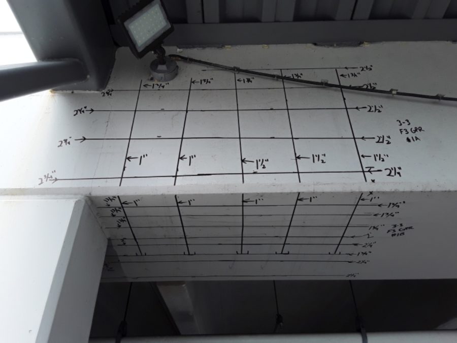
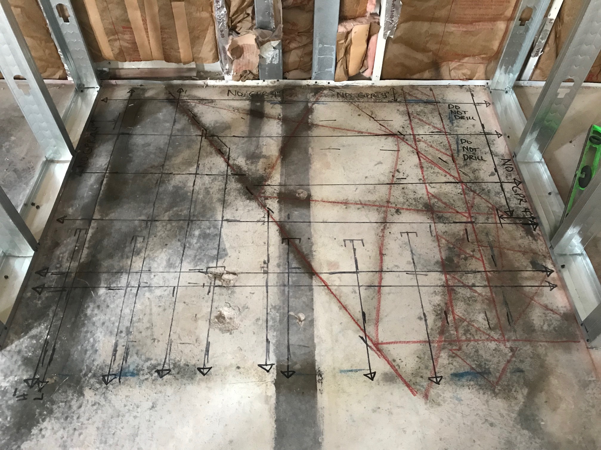
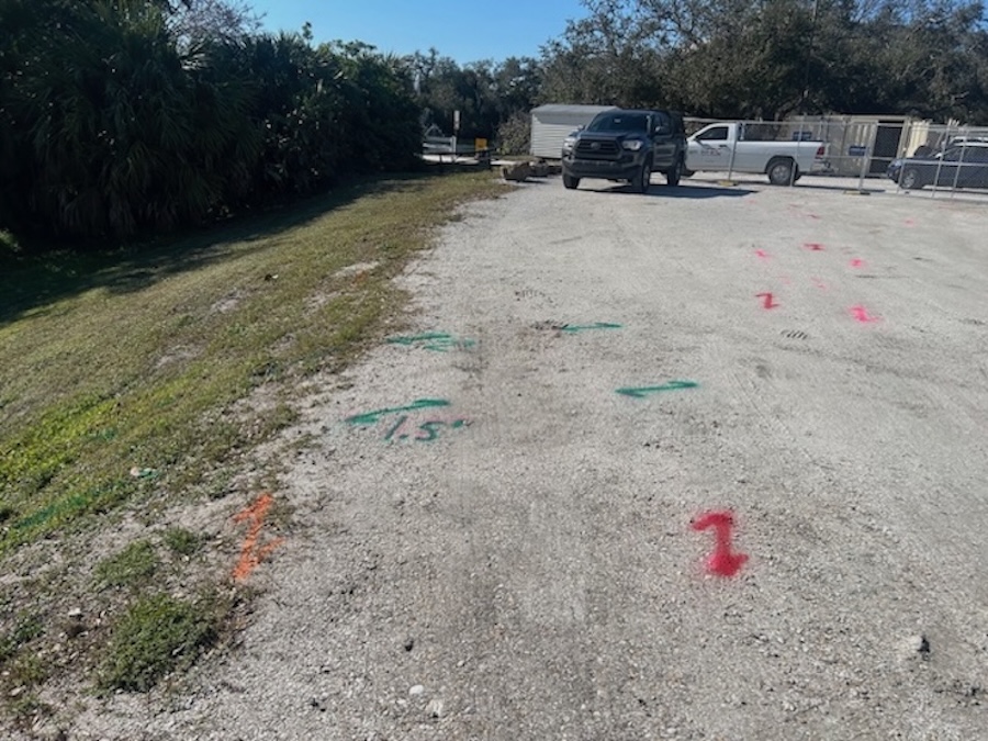
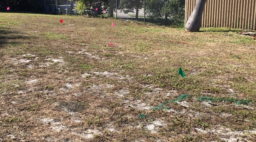
A utility locating project using GPR and Electromagnetic induction was completed by GPR Scanning Services, LLC. The customer was in the design phase to construct a cell tower and related equipment. In an effort to avoid existing utilities, the site required a utility locate prior to finalizing the design and placement of the tower. The utility locating project involved scanning an area approximately 50′ wide by 175′ long using ground penetrating radar to determine the presence of utilities. A 400MHz ground penetrating radar antenna was used on this project. The antenna is capable of reaching depths up to 10′. The depth range of the antenna is dependent upon the soil type and soil conditions during the locating service. The technician on-site pushed the antenna along the surface in a grid pattern. By completing a grid pattern, the technician can determine the direction and depth of the utilities in the scan area. Along with GPR scans, a utility wand and transmitter was used to sweep the area for live power and other voltage lines. The transmitter can be partnered with the transmitter to send a frequency signal onto exposed utilities using a tracer wire or induction onto the utility. The service also included the opening of manholes and covers to determine the direction and depth of storm drains and sanitary lines. The service resulted in numerous utilities being located and marked. The utilities were spray-painted onto the ground and flagged when located. In addition to the locating of the utilities, the customer requested a GPS map to document the findings. The technician was able to map the findings of the utility locate using a GPS unit with sub-meter accuracy. The GPS data was downloaded and placed into a Google Earth format for reference. A kmz file was also provided which allowed the customer to see coordinates and notes for each of the utilities located.